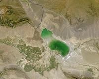
China can now view the entire country's land mass using HD satellite images, it was announced at a national geo-mapping conference held on Friday.
According to a statement issued by the National Administration of Surveying, Mapping and Geoinformation, China began capturing remote-sensing images with clear view of objects of a meter in length or smaller since 2012.
By October 2014, such high-resolution images had covered China's entire land territory.
Meanwhile, China's cities are being upgraded to smart cities or digital cities.
FY-2C satellite successfully deorbited
Beijing, December 26 (XNA) – FY-2C was the first operation application satellite of FY-2 satellites and the first geostationary meteorological satellite achieved continuous and stable operation in-orbit. It was launched in October 19, 2004 and stopped operation in November 25, 2009. After that, the satellite had been in backup status.
The deorbited work was officially started at 10:00 a.m. of December 10 and finished on December 13. After deorbiting, all instruments of the satellite were closed. The whole process and the results met our mitigation specifications of space debris and IADC tasks.
Currently, there were three FY-2 geostationary meteorological satellites in-orbit. At the end of December, China will launch the FY-2 08 satellite to further protect the needs of the operation. (Dec. 25)
