EUREKA project E! 2294 IMAGIN — the "Integrated Machine Guidance Instruments" — uses satellite navigation to automatically guide and control road and rail construction machines with incredible accuracy.
The IMAGIN device is a special dual-frequency Global Positioning Satellite (GPS) receiver that is attached to an engineering machine and uses the GPS system to plot and check its exact position at any moment in time. Once a project is described by a civil engineer and the instructions transferred to the IMAGIN on-board computer, the motor grader, bulldozer or excavator is then automatically controlled by comparing its actual and desired positions, making corrections as required.
"The principle of IMAGIN can be applied to any civil engineering machine, whatever its task," explains Christophe Pichot, Strategy and Business Development Manager of French lead partner, THALES-Navigation.
It has been used successfully on bulldozers, hydraulic excavators and marine survey ships, but most demanding in terms of accuracy and speed is the control of motor graders that are used in the final finishing of road or railway construction where high levels of accuracy are required over tens of kilometres.
"Although automatic control has been possible using laser guidance, the IMAGIN GPS system makes it possible to work accurately in automatic mode, guaranteeing the quality of the work, preventing excessive cutting of the material and reducing waste," says Pichot. "After the initial installation it doesn't require expensive manpower or maintenance as the machine progresses."
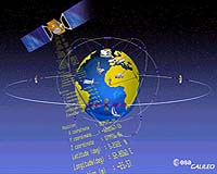
GALILEO European satellite
