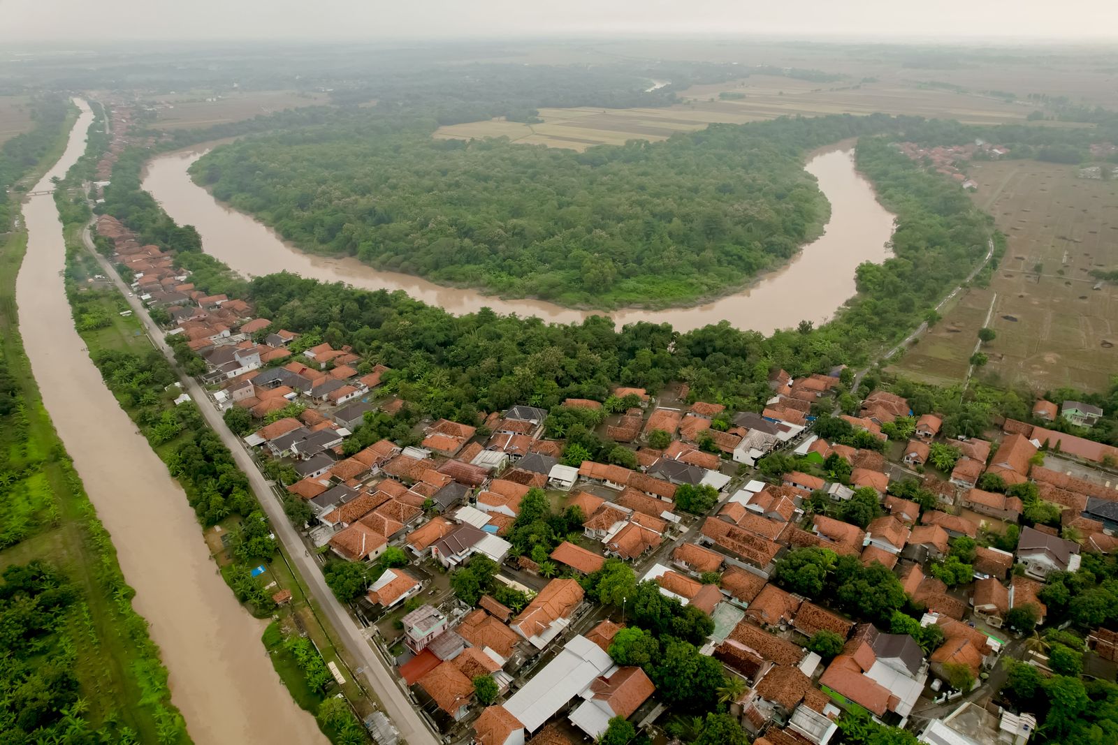
The Netherlands, a country whose national self-image is built on holding back the sea, has spent the past two decades doing the opposite. Under a programme called Ruimte voor de Rivier — Room for the River — the Dutch government deliberately lowered dykes, dug out floodplains, relocated levees inland, and paid farmers to accept seasonal inundation across sites along the Rhine, Waal, IJssel, and Meuse. The project reversed roughly four hundred years of hydraulic doctrine that had said the only good river was a river squeezed tight between ever-higher walls.
The reason was arithmetic. In 1993 and again in 1995, the Rhine came within centimetres of overtopping the dykes near Nijmegen. Hundreds of thousands of people were evacuated. Dutch engineers looked at the discharge curves and projected that climate change would push peak flood levels substantially higher by mid-century. Building the walls higher would work for a while. Then it would stop working, and when it stopped working, the failure would be catastrophic.
Four centuries of raising the walls
Since the seventeenth century, the standard Dutch response to a river that flooded was to make the dyke taller. Windmills drained the polders behind them. The rivers, hemmed in, ran higher and faster between their embankments, depositing silt on the riverbed rather than on the surrounding land. Over generations the river channels rose above the level of the fields they ran past, so that in places the Rhine now flows several metres higher than the farmhouses on either side.
That geometry is stable only as long as the dykes hold. When they fail, the water does not spread gently — it falls. The 1953 North Sea flood, which killed over 1,800 people in Zeeland, was the modern trauma that drove the Deltawerken, the sea defences. The 1993 and 1995 river scares were the freshwater equivalent, and they arrived just as European climate models were starting to project heavier winter rainfall across the Rhine basin.
The maths of a bigger flood
A dyke tall enough to contain a major flood is not simply a taller version of a dyke built for lower discharge. The load on the structure scales with the square of the water height. The zone of catastrophic damage behind it grows too, because the potential energy stored against the wall is greater. Dutch hydraulic engineers concluded that continuing the four-century strategy would eventually produce a failure mode with no survivable outcome for the towns behind the levees.
Widening the channel — giving the river somewhere to go sideways instead of forcing it up — flattens the peak. A floodplain that absorbs a metre of water across ten square kilometres removes ten million cubic metres from the flood wave. Do that in multiple places along the river and the peak discharge that reaches the critical urban stretches drops by a measurable margin. At Nijmegen, where the Waal takes a sharp bend past the old city, the project relocated the north dyke inland and dug a parallel side channel, lowering peak flood levels there substantially.
Paying farmers to get wet
The awkward part was that the land the river needed to occupy already belonged to someone. Most of it was farmland — dairy pasture, orchards, arable fields — held by families who had worked the polders for generations. The Dutch state could have expropriated it. Instead, in most cases, it bought the land outright or negotiated flood easements: farmers kept working the fields in dry years and received compensation for the years the water came in.
The compensation model matters. Similar logic has been applied elsewhere with mixed results — in the American Midwest, the 2019 Mississippi floods devastated farmers who had no such buffer and lost entire seasons of soybeans and corn, as Business Insider documented across the delta. Dutch payments were structured so that a wet field was not a ruined livelihood. In parts of the Overdiepse Polder, entire farmsteads were physically raised onto engineered mounds — terpen, the same word used for the artificial hills medieval Frisians built before dykes existed — so that the houses and barns stood dry while the surrounding pasture flooded.
What the river does when you let it
A river given room does not just carry water. It carries sediment, seeds, fish, and nutrients, and it does things a canalised river cannot. The reopened floodplains along the Waal and IJssel have redeveloped gravel banks, willow thickets, and shallow spawning grounds that had been absent for a century. Fish populations, including salmon, have begun to recover in monitoring surveys. Beaver populations, reintroduced in the Biesbosch decades ago, expanded into the new wet zones.
The ecological logic parallels what other delta authorities have started building into their flood plans. California’s climate-adapted flood management strategy emphasizes expanding flood bypasses and restored floodplains rather than simply raising levees along the Sacramento and San Joaquin. The Yolo Bypass north of the delta, where farmers grow rice in summer and the state deliberately floods the fields in winter, is the closest American analogue to the Dutch model, and the California Department of Water Resources has expanded it through a series of riverine restoration projects including new fish passage structures at the Fremont Weir.
The soil pays a dividend
Farmers who accept periodic flooding do lose crop days. They also, in most cases, gain something. Silt-rich floodwater deposits fine mineral particles and organic matter across the fields, replenishing the exact nutrient stock that intensive agriculture strips out. Research on conservation practices has found that controlled inundation, combined with cover cropping and reduced tillage, can measurably improve soil water retention and reduce downstream flood peaks at the same time.
Work on agricultural resilience under climate stress reaches a similar conclusion from a different direction: soils that participate in the water cycle — that absorb, hold, and release — are more productive across a full decade than soils that are simply drained as fast as possible. The Dutch farmers who took the flood compensation deals were, in effect, being paid to let the river do the fertilising their grandparents’ fathers had done with barge-loads of dredged mud.
The politics of unbuilding
None of this was easy politically. Room for the River required moving households, demolishing farm buildings, and telling communities whose identity was tied to a specific patch of polder that the patch was going back to the river. The programme worked partly because the Dutch state committed early and clearly to compensation, and partly because the 1995 evacuation was recent enough that voters understood the alternative.
Delta nations that have not had a recent near-miss find it much harder. The Niger Delta, one of the largest river deltas in the world, has seen its natural flood regime disrupted by decades of oil extraction and channel modification, with communities pushed into poverty as the sediment and nutrient cycles that supported traditional agriculture broke down. Reversing that kind of damage is harder than preventing it. Reversing it while also paying compensation to the people who live on the affected land is harder still.
Sediment, subsidence, and the sinking delta
There is a second reason the Dutch stopped raising dykes, and it has to do with what happens under them. Polders that are drained continuously oxidise their peat soils and compact. The land sinks. Parts of the western Netherlands are now more than six metres below sea level and still dropping by several millimetres a year. Every centimetre of subsidence effectively adds a centimetre to the height the dykes must hold.
Delta subsidence is a global problem. California’s Central Valley has lost as much as nine metres of elevation in some places over the past century from groundwater pumping, and the state’s Department of Water Resources is now installing new GPS stations and remote sensing calibration equipment to monitor vertical land movement to millimetre precision. Letting the river deposit sediment back onto the floodplain is one of the few natural mechanisms that can slow subsidence, because the fresh silt raises the surface even as the underlying peat compacts.
Spacewar has explored the reverse problem on the Loess Plateau, where Chinese engineers terraced 640,000 square kilometres to cut the Yellow River’s sediment load by nearly 90 percent — a triumph of erosion control that has the unintended consequence of starving the Yellow River delta of the material it needs to keep pace with sea-level rise. The Dutch problem and the Chinese problem are mirror images: too little sediment in the wrong places, too much in others, and in both cases the delta pays.
How much room, exactly
The Room for the River programme targeted a specific number: a safe discharge capacity of 16,000 cubic metres per second on the Rhine at Lobith, the point where the river enters the Netherlands from Germany. That was the design flood for the 2015 completion date. Longer-range planning documents already talk about 18,000 as the target for 2050 and note that beyond roughly 20,000 cubic metres per second, no combination of widening, deepening, and dyke reinforcement is likely to be sufficient — at which point the strategy has to shift again, possibly to controlled evacuation zones on a scale the country has not attempted since 1953.
The sites that were widened, lowered, or relocated between 2007 and 2019 collectively added something like 150 million cubic metres of storage to the Rhine-Meuse system in flood conditions. That is roughly the volume of 60,000 Olympic swimming pools, held not behind a dam but spread thin across pastures and side channels.
What the fields look like now
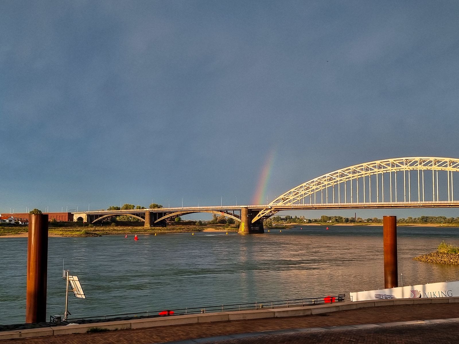
Drive along the Waal past Nijmegen on a January afternoon after a wet week in the German Rhineland and you can see the design working. The main channel is high and brown. The relocated dyke stands hundreds of metres back from where it used to be. Between them, a shallow secondary channel runs across what was, until 2016, a suburb called Lent. A footbridge crosses the new water. Cattle graze on grass that will be under a metre of river in February.
The farmers on the compensated fields have adjusted their calendars. Grazing ends earlier in autumn. Machinery moves out by December. In April, when the flood recedes, the fields come back covered in a thin layer of fresh silt that smells faintly of iron. The grass that grows through it is, by most accounts, unusually good.
Four centuries of raising the walls produced a country that could not afford one more failure. Two decades of lowering some of them, and paying the people who lived behind them to share the water, produced a river that behaves — for now — like something the Dutch can live with.