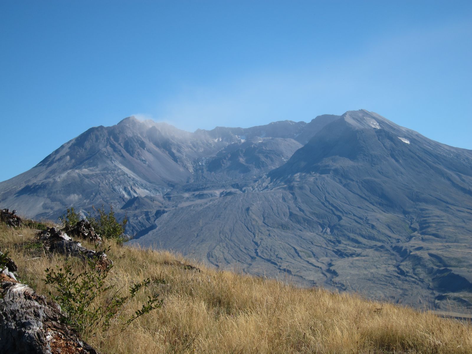
At 8:32 a.m. on May 18, 1980, a magnitude 5.1 earthquake shook Mount St. Helens as the volcano’s swollen north flank and summit collapsed. The landslide released pressure inside the volcano and helped trigger the lateral blast that devastated about 230 square miles around the mountain.
The North Fork Toutle River valley was buried principally by the debris avalanche, not by ashfall. USGS says most of the avalanche turned west and traveled about 14 miles down the valley, leaving a hummocky deposit. Lahars followed through the drainage later that day as water mixed with loose volcanic debris.
Forty-six years later, much of the damaged landscape is green again. But the recovery is not a simple story of a single blank surface rebuilding in a single way. Some places retained buried soil, roots, seeds and animals. Others were stripped or buried so completely that colonization had to begin almost from scratch.
The morning the mountain came apart
Fifty-seven people died in the eruption, including U.S. Geological Survey volcanologist David A. Johnston. The disaster transformed volcano science in the Cascades as well as the landscape itself. The Cascades Volcano Observatory was later dedicated in Johnston’s memory.
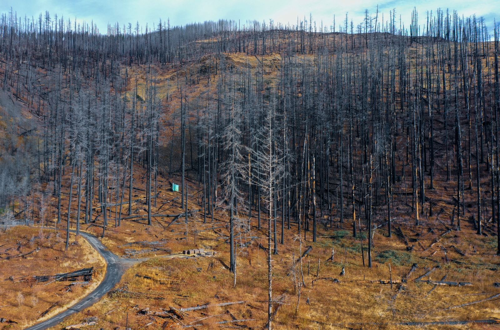
The ecological damage was not uniform. Close to the volcano, pyroclastic flows created the Pumice Plain, where the former ecosystem was effectively erased. Farther out, trees were blown down or scorched while patches of soil, plants, fungi and animals survived under snow, underground or behind protective terrain.
That patchwork turned out to matter. Scientists arriving after the eruption found that recovery depended heavily on what had survived each particular combination of heat, burial, scour and blast force.
What was left alone, and what was replanted
Congress established the Mount St. Helens National Volcanic Monument in 1982. Within the monument, areas affected by the eruption were set aside to respond naturally, creating an unusually large landscape for long-term study of ecological succession.
The surrounding blast zone was not handled the same way. Weyerhaeuser says 68,000 acres of its forestland were affected and that it began planting 18 million seedlings within months. The protected research landscape and the actively managed timberlands therefore tell different recovery stories.
That distinction matters because Mount St. Helens is sometimes described as though every green patch returned without human intervention. The more accurate story is that large protected portions recovered through natural succession while other damaged lands were deliberately replanted.

The gophers that survived underground
Northern pocket gophers, Thomomys talpoides, spend much of their lives below ground. In disturbance zones where they survived the eruption, their burrows became an important connection between buried pre-eruption soil and the new surface. The Forest Service reports that surviving gophers mixed underlying soil with volcanic ash as they tunneled, creating places where roots and seeds could establish.
That did not happen everywhere at once. On the Pumice Plain, where pyroclastic deposits had wiped away the former forest, northern pocket gophers did not naturally become established until roughly 12 years after the eruption. The difference is important: gophers were survivors in some zones and later colonists in others.
James MacMahon’s Utah State research teams began studying small mammals on the mountain in 1980. Charles Crisafulli joined that work as a 22-year-old undergraduate student, beginning what became a decades-long research career centered on Mount St. Helens.
Lupines helped turn pumice into habitat
The Pumice Plain offered a different ecological problem. Its fresh deposits contained little organic matter or available nitrogen. A 2024 peer-reviewed follow-up by Mia Rose Maltz, Michael F. Allen and colleagues summarizes earlier research by Allen and James A. MacMahon showing that scattered prairie lupines had established there by 1981 and formed small patches by 1982.
Prairie lupine, Lupinus lepidus, has an advantage on nutrient-poor ground because bacteria associated with its roots can fix atmospheric nitrogen. The Mount St. Helens Science and Learning Center describes that nitrogen-fixing partnership as a key reason lupine succeeds as an early colonizer.
The plants also change the ground after they die. Their leaves and stems add organic matter, while dead plant structures catch windblown seeds and create small protected seedbeds. Recovery spreads through these local changes rather than through one uniform wave moving across the whole plain.
Elk returned faster than the forest
Large mammals also returned quickly. Forest Service researchers report that elk and deer were back in the blast area during the first summer. Their effects were mixed: hoofprints disturbed ash and trapped windblown seed, while the animals also carried seeds and spores through their digestive systems and deposited them in feces.
But elk were not simply restoration machines. Heavy grazing could suppress developing vegetation, and the animals also moved seeds of non-native plants. On the Pumice Plain, repeated browsing has slowed the return of some trees and shrubs even while elk have helped spread grasses and other species.
The result is another reminder that ecological recovery is not the same thing as a march toward a predetermined forest. Animals can accelerate one process while slowing another, and the landscape that emerges reflects both effects.
What the satellites actually show
NASA Earth Observatory has used Landsat imagery to show the scale of that change from above. Its published comparison places an August 20, 2013 Landsat 8 image beside a June 17, 1984 Landsat 5 image of the same area.
The broad trend is unmistakable: vegetation expanded dramatically across much of the disturbed landscape. But the satellite view also reinforces what researchers found on the ground. Different disturbance zones recover at different rates because they began with different depths of volcanic material, different surviving biological legacies and different access to incoming seeds and animals.
Why the natural-succession areas matter
The monument’s value is not that every acre proves nature recovers better without people. The stronger scientific value is that large areas were allowed to change without routine replanting, giving researchers a long-running record of what different disturbance zones do when surviving organisms and natural colonists are allowed to set much of the trajectory.
Adjacent planted forests answer a different question. They show what deliberate timber recovery can produce after catastrophic disturbance. Keeping those stories separate prevents the Mount St. Helens recovery from being flattened into a slogan about either intervention or non-intervention.
The enduring lesson from the protected blast zone is more specific. What survives matters. Buried soil matters. A pocket of vegetation behind a ridge can matter. So can a gopher moving old soil upward, a lupine adding nitrogen to bare pumice, or an elk carrying seed from one patch to another.
The mountain is still active
Ecological recovery has unfolded beside an active volcano. A FOX 13 report published on May 18, 2026 described 18 seismometers positioned within seven miles of Mount St. Helens and said the network was detecting an average of 17 earthquakes per month at the time.
A separate earthquake figure often associated with the mountain belongs to an earlier period. USGS records show that approximately 350 earthquakes were located between February 1 and June 17, 2024, with more than 95 percent below magnitude 1.0.
The volcano also produced renewed dome-building eruptions from 2004 to 2008. Monitoring today is part of the scientific legacy of 1980, when the eruption demonstrated both the hazards of the Cascades and the need for permanent observation.
What decades of watching have shown
The blast zone has never followed a single recovery timetable. Some organisms survived underground or beneath snow. Others arrived from the edges. On the Pumice Plain, new communities assembled on volcanic material that began with almost none of the biological inheritance of the former forest.
The mechanisms are ordinary when viewed one at a time: animals move soil, bacteria fix nitrogen, seeds hitch rides, roots stabilize new ground and surviving patches provide starting points. Over decades, those small processes become visible at landscape scale.
SpaceWar has followed other Pacific Northwest examples where changing physical conditions alter what can return, including tidal reconnection in a restored coastal estuary and wildlife movement across I-90 at Snoqualmie Pass. Those projects operate through different mechanisms, but each makes the physical structure of habitat part of the ecological story.
Mount St. Helens remains the larger and stranger experiment. The eruption did not leave one blank slate. It left dozens of starting conditions beside one another, and scientists have spent more than four decades watching the consequences.
Gophers still turn soil. Lupines still alter nutrient-poor ground. Elk still move through recovering habitat. The landscape is greener than it was in 1980, but the more revealing fact is that its recovery remains uneven, unfinished and measurable.